After a hailstorm, the slowest part of a property claim is often a ladder: an adjuster driving to each home, climbing a steep roof, and photographing damage by hand. As the Project Manager at Acquaint Softtech, a partner that delivers AI development services to insurers and inspection platforms, I have seen drones remove that bottleneck, but only when the software behind them is built properly.
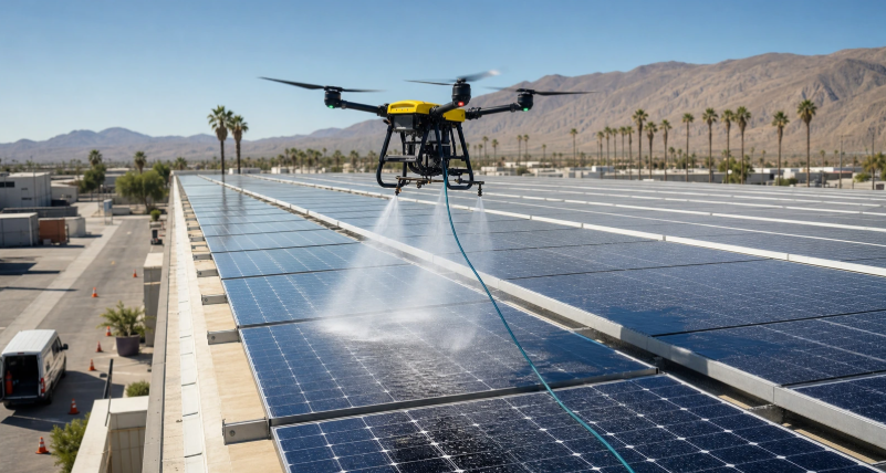
Drone-based property claim inspection captures aerial imagery of a damaged roof, solar array, or commercial building, then turns it into measurements, damage findings, and evidence for the claim file. This guide covers aerial damage assessment for roof, solar, and commercial claims, plus the pipeline that connects a flight to a settlement.
A drone that flies well but delivers unusable data saves nothing, because the adjuster still has to go back. The approach below draws on AI and inspection platforms that Acquaint Softtech has delivered as an Official Laravel Partner, with 1,300+ projects, 70+ in-house engineers, and clients across the USA, UK, Europe, and Australia who get a dedicated team within 48 hours of a brief.
What drone-based claim inspection is
Drone-based claim inspection is the use of unmanned aircraft to capture visual, thermal, or 3D data of insured property after a loss. Software then measures the structure, detects damage, and attaches the evidence to the claim.
Why insurers adopt it
Drones keep adjusters off steep and fragile roofs, reach sites that are unsafe after a catastrophe, and capture complete, geotagged coverage instead of selected photos. Consistent imagery also makes disputes and reinspections easier to resolve.
Roof, solar, and commercial at a glance
Each property type needs a different sensor, flight plan, and analysis. Treating them the same is the most common reason drone programs produce data adjusters cannot use.
| Property type | Primary data | What the software must find |
| Residential roof | High-resolution RGB images, 3D model | Hail hits, wind-lifted shingles, roof measurements |
| Solar array | Thermal and RGB imagery | Hotspots, failed strings, physical panel damage |
| Commercial roof | Orthomosaic, thermal, 3D model | Membrane damage, ponding, trapped moisture |
Roof claims: hail, wind, and measurement
For residential roofs, the drone must deliver two things: accurate measurements and clear evidence of storm damage. Measurements come from photogrammetry, the process of building a scaled 3D model from overlapping photos.
Evidence adjusters can rely on
Capture close-range images at a consistent ground sample distance (GSD), the real-world size each pixel represents, so hail bruising and cracked shingles are visible. Many adjusters still count hits in a 10-by-10-foot test square per roof slope, so the software should mark test squares directly on the imagery.
Damage detection models then flag likely hail and wind damage for review. Teams that hire Python developers typically build these computer vision pipelines, because Python carries the main training and inference libraries.
Solar claims: thermal imaging and panel faults
Solar claims need thermal imaging, because many panel faults are invisible in normal photos. A damaged or faulty cell runs hotter than its neighbours, and a radiometric thermal camera records that temperature difference.
Inspect under the right conditions
Aerial thermography of PV plants is covered by IEC TS 62446-3, which recommends inspecting under strong, stable sunlight so faults show clearly. The software should record irradiance and time with each flight, because a thermal image taken in poor conditions can hide real damage.
Classify findings by type: single-cell hotspots, bypass diode failures, whole-string outages, and cracked or shattered glass. That separation matters, because a storm-damaged panel is covered while normal degradation usually is not.
Commercial claims: large and flat roofs
Commercial claims involve large, often flat roofs where walking the surface takes hours and misses hidden damage. Drones capture the whole roof as an orthomosaic, a single map-accurate image stitched from hundreds of photos.
Finding damage you cannot see
Thermal flights shortly after sunset can reveal water trapped beneath a roof membrane, because wet insulation releases stored heat more slowly than dry areas. Combine that with visual evidence of punctures, seam failures, and ponding to separate storm damage from long-term wear.
From flight to claim file: the software pipeline
The value of a drone inspection lies in the pipeline after landing: upload, processing, analysis, review, and delivery into the claims system. Each step must preserve the evidence trail.
Five steps that make data usable
First, upload images with their GPS, altitude, and timestamp metadata intact. Second, process them into models, orthomosaics, and measurements. Third, run damage detection. Fourth, route findings to an adjuster for review. Fifth, push the report, measurements, and evidence into the claim and estimating tools.
Pilots must also fly legally. In the US, commercial drone work falls under FAA Part 107, which requires a certified remote pilot, while the UK CAA, EASA in Europe, and CASA in Australia apply their own rules. Store each pilot’s certification and flight log with the inspection record.
What it costs to build
The cost of a drone inspection platform depends on the property types covered, how much analysis is automated, and how deeply it integrates with claims and estimating systems.
| Scope | What you get | Typical range (USD) |
| Inspection pilot platform | Upload, processing, review portal, reports | $35,000 to $75,000 |
| Full aerial claims platform | AI detection, thermal analysis, integrations, pilot management | $75,000 to $180,000+ |
Where the savings are
Start with one property type and a review portal, then add automated detection once you have labelled imagery to train on. An MVP development approach proves value on real claims before you scale. This staged build runs at up to forty percent cost savings versus Western agencies, with blended rates of roughly twenty-five to forty-nine US dollars per hour.
Proof: an AI damage inspection system we shipped
Aerial claim inspection depends on an AI model that finds damage reliably in imperfect conditions. Acquaint Softtech built a new AI inspection model and web platform for Good2Know, an Estonia-based vehicle inspection company, that detects damage and evidence of prior repairs from photos. The account below is drawn from the client’s verified 5.0 out of 5 Clutch review.
| Challenge | Solution | Result |
| Model missed small defects | Improved tagging and a new training pipeline | Detects dents, odd lines, and repair reflections |
| Poor results in low light | Enhanced image preprocessing | Model worked in weakly lit conditions |
| Users unsure why parts were flagged | Confidence explanations and admin review of flagged cases | Fewer complaints about ambiguous results |
It inspects cars from phone photos, not roofs from drones, but the technical problem is the same: labelled imagery, a detection model that handles poor conditions, confidence shown to reviewers, and a human check on flagged findings.
FAQs
What is drone-based property claim inspection?
It is the use of drones to capture visual, thermal, or 3D data of damaged insured property. Software then measures the structure, detects damage, and adds the evidence to the claim file.
Can drones replace adjusters on roof claims?
No. Drones replace the ladder, not the adjuster. They capture safer and more complete evidence, while a licensed adjuster still reviews findings and decides coverage and settlement.
How do drones inspect solar panels for damage?
They use radiometric thermal cameras to find panels running hotter than normal, such as hotspots and failed strings, alongside visual images that show cracked or shattered glass.
Do insurers need a licence to fly drones for inspections?
Pilots need certification under local rules, such as FAA Part 107 in the US. The UK, Europe, and Australia each have their own drone regulators and requirements.
How accurate are drone roof measurements?
Accuracy depends on flight planning, image overlap, and ground sample distance. Well-planned flights processed with photogrammetry produce measurements reliable enough for estimating.
Can AI detect hail damage from drone images?
Yes. Computer vision models can flag likely hail and wind damage on roof imagery. Findings should still be reviewed by an adjuster before they affect a claim decision.